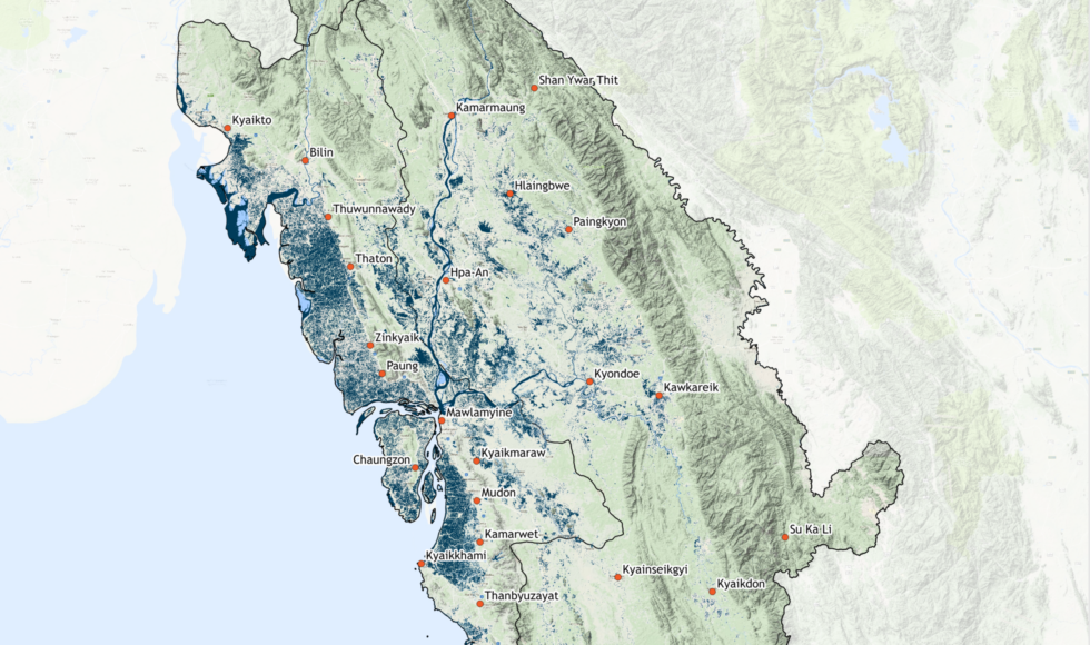
Myanmar has experienced extreme flooding in July of this year. Heavy monsoon rains have flooded villages, forcing more than 100.000 people to flee their homes. Mon and Kayin state have been hit hardest, especially along the Thanlwin river. The effects of the heavy monsoon rains are further aggravated by consequent levels of deforestation, according to environmentalists (NYT).
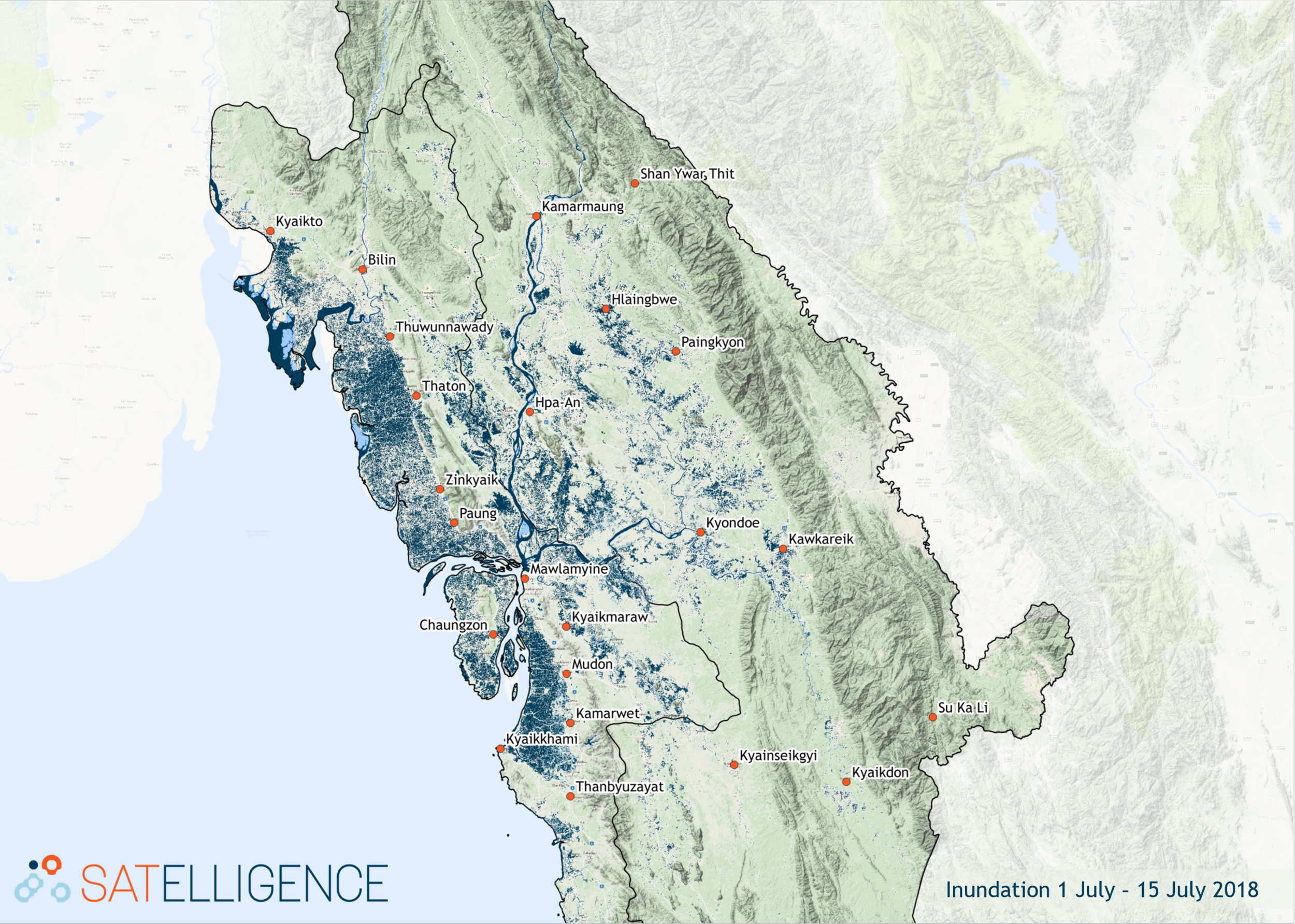
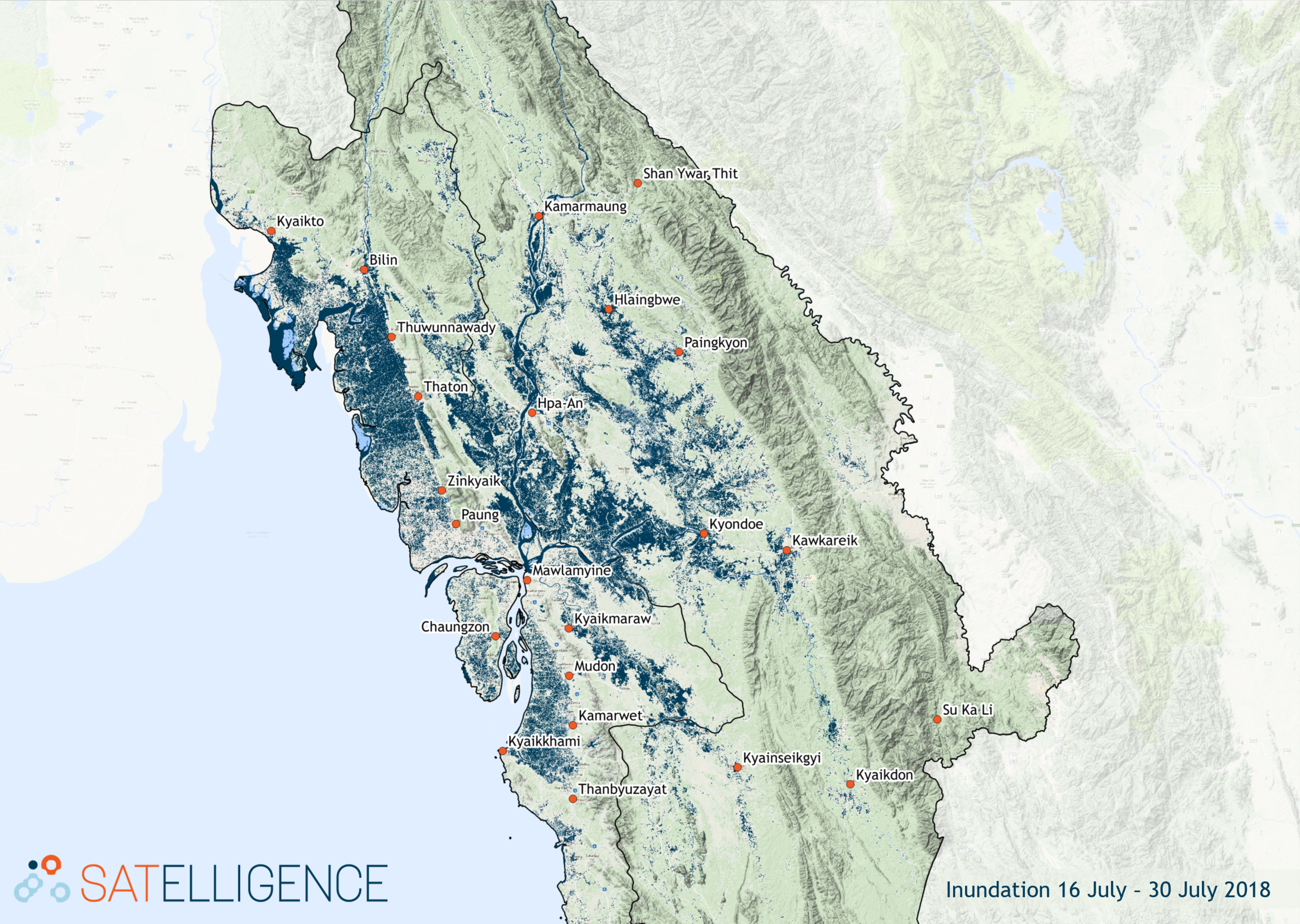
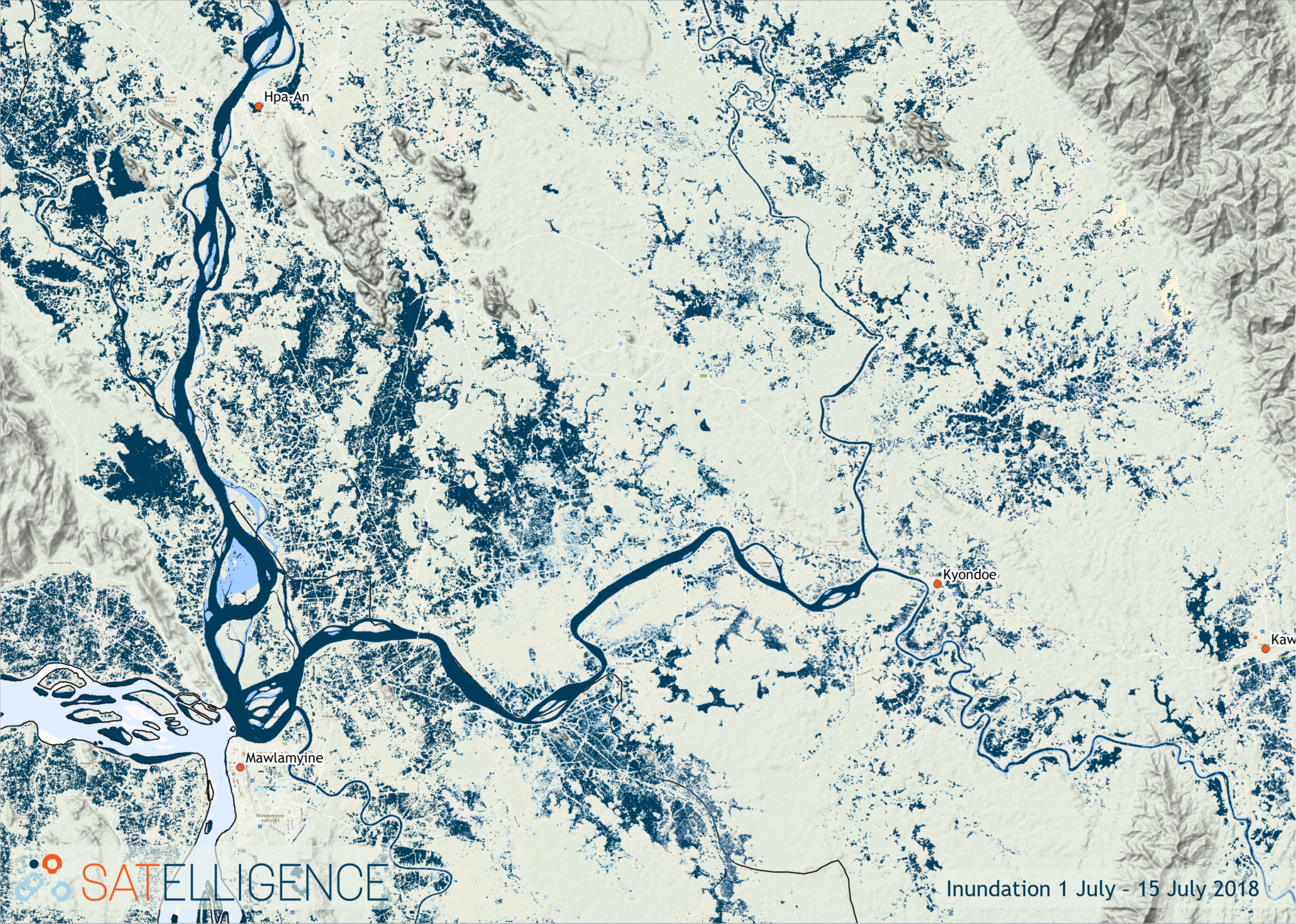
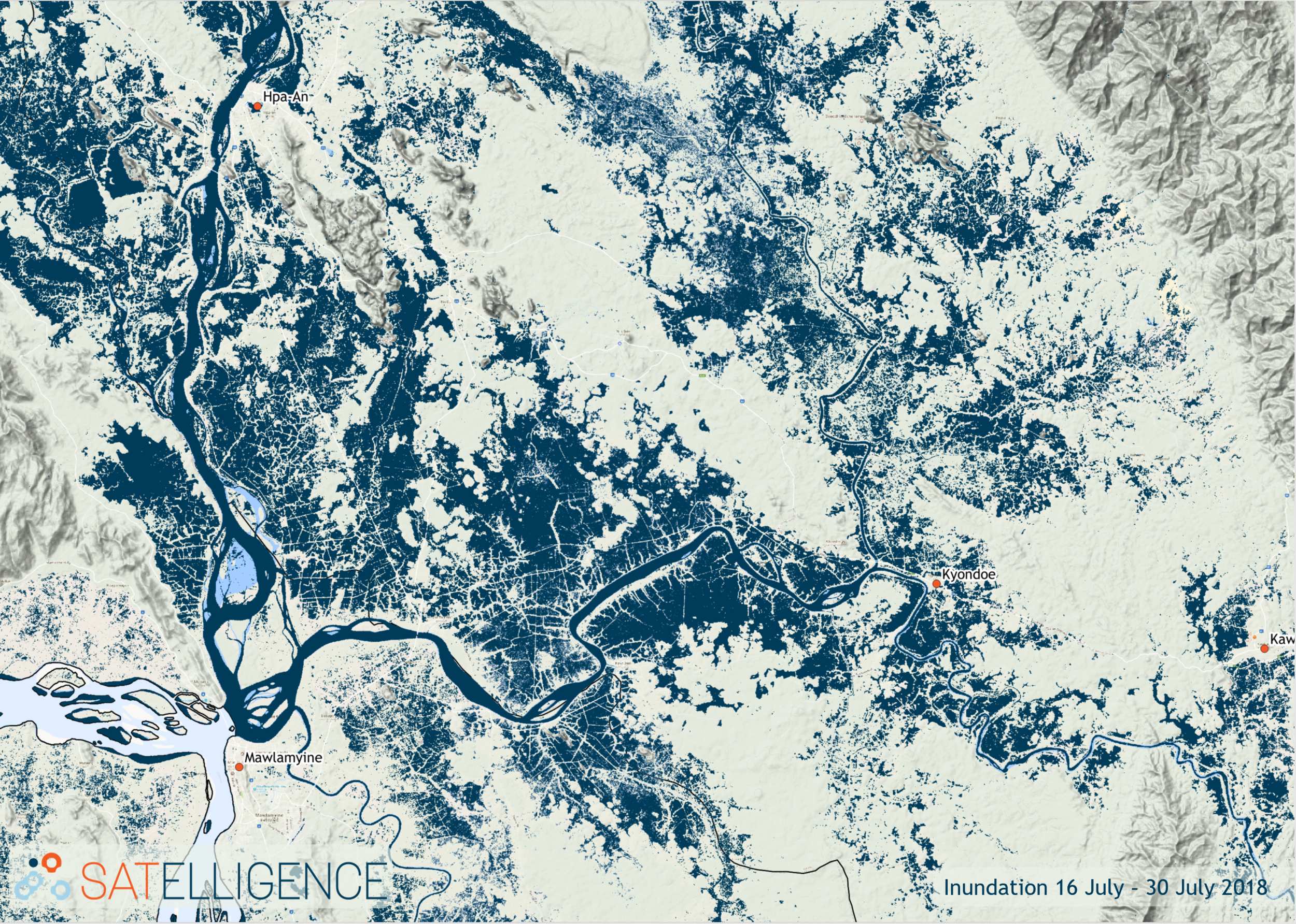
To understand the extent of flooding, Satelligence has processed the latest Sentinel 1 imagery. The following maps show the size of inundated areas in Mon and Kayin state over the first and second half of July:
