About Touton
Touton is a leading agro-industrial acto that delivers quality, responsibly sourced cocoa, coffee, vanilla and natural ingredient products to its customers around the globe. With subsidiaries in originating regions, and agents in key locations, Touton’s strength lies in the skills of its workers, the cultural diversity of its teams, and a deep understanding of the countries in which the company operates.
Context
Between 1950-2000 Ghana suffered one of the highest deforestation rates in the world; over five decades the country lost about 60% of its forest cover. Touton has teamed up with Satelligence to eliminate deforestation in its supply chains and generate value for buyers, consumers and investors.
Touton pioneered the landscape approach in Ghana before they started tackling their supply chain with Satelligence. In 2017, they founded The Partnership for Productivity Protection and Resilience in Cocoa Landscapes (3PRCL); a consortium that aims to improve conditions for cocoa farmers in Ghana’s Juabeso-Bia district “within a sustainable landscape.” With 3PRCL, Touton built mutually invaluable relationships with cocoa farmers to increase efficiency, accountability and trust: the tools to tackle deforestation from the ground up.
The governance structures they developed under 3PRCL were the ideal springboard for their ongoing work with Satelligence; satellite monitoring combined with tight stakeholder relations will enable better detection, investigation and measurable action in their anti-deforestation measures.
Solution
Satelligence proposed two phases for the project:
Phase 1: Satelligence were to build an adjusted Forest Loss Risk Index (FLRI). This established a baseline for deforestation risk that covered the chosen areas of Ghana and Cote d’Ivoire.
Phase 2: Real-time monitoring, through satellites and on the ground verification, of High and Medium risk areas of deforestation, as per phase 1’s risk analysis. Quarterly reports are given to re-prioritise areas and keep track of changes to risk levels.
Touton’s commitment to building trust with the cocoa farmers of Ghana is the collaboration’s keystone. Their bedrock of support combined with Satelligence’s ability to provide real-time radar and satellite monitoring allows Touton to enrich existing stakeholder relationships and implement anti-deforestation measures. This collaboration isn’t just performative, it’s about building long-term structures that nurture the African cocoa industry.
Phase 1: The Nature of Things, Delivering a Better FLRI
The FLRI is an industry standard developed by Olam Cocoa and the WRI to help cocoa companies map and prioritise risk in their supply chains. The benefits of building a transparent picture of cocoa supply chains are twofold: companies are empowered to take control of their supply chains, and demonstrate to investors, buyers and clients that nothing is obscured. Risk is determined within an area of interest and its buffer zone by comparing the forest level of 5 years ago with forest loss over the past 5 years to create a forest loss ratio.
For the Touton FLRI, Satelligence proposed the following criteria:
- Improved progress reporting for clients and investors;
- Better targeted interventions;
- Mitigation of deforestation before it happens;
- Quantifying the number of high and low risk cocoa farms;
- Establishing the highest risk sourcing areas;
- Identifying farmers that produce in high risk areas;
- Locating deforestation hotspots;
- Verifying whether cocoa-related deforestation occurs in national parks, reserves and other protected areas;
- Identifying trends in cocoa-related deforestation over time.
The base methodology, built by Olam and Global Forest Watch, provided Satelligence with a platform from which they could refine their report according to widely accepted industry standards. Their close relationship with the World Cocoa Foundation and Climate Focus helped to keep them aligned with industry consensus approaches, while their own expertise granted deeper insight.
Satelligence blended a cocktail of elements to create a cohesive deforestation report. They used GPS mapping of Touton’s entire cocoa supplier network, then overlaid additional risk factors to develop an advanced FLRI, including:
- Forest baseline 2016
- Historical deforestation 2016-2020
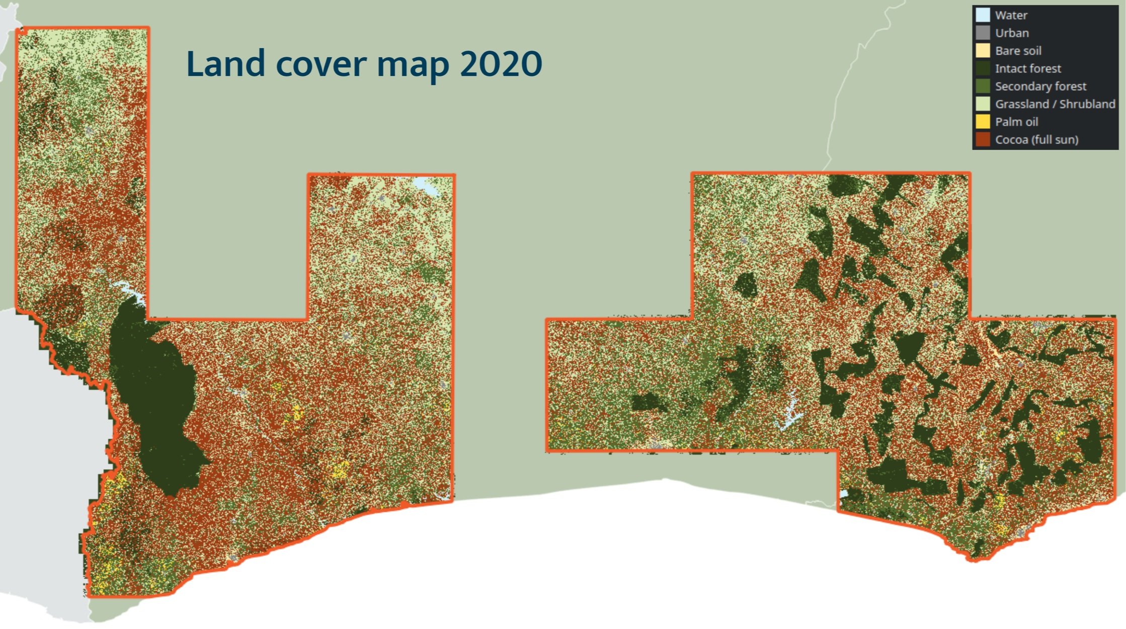
- Land cover map 2020 (for distance to existing cocoa and other plantations)
- Protected areas
- Terrain (slope map)
- Road networks
- Population density

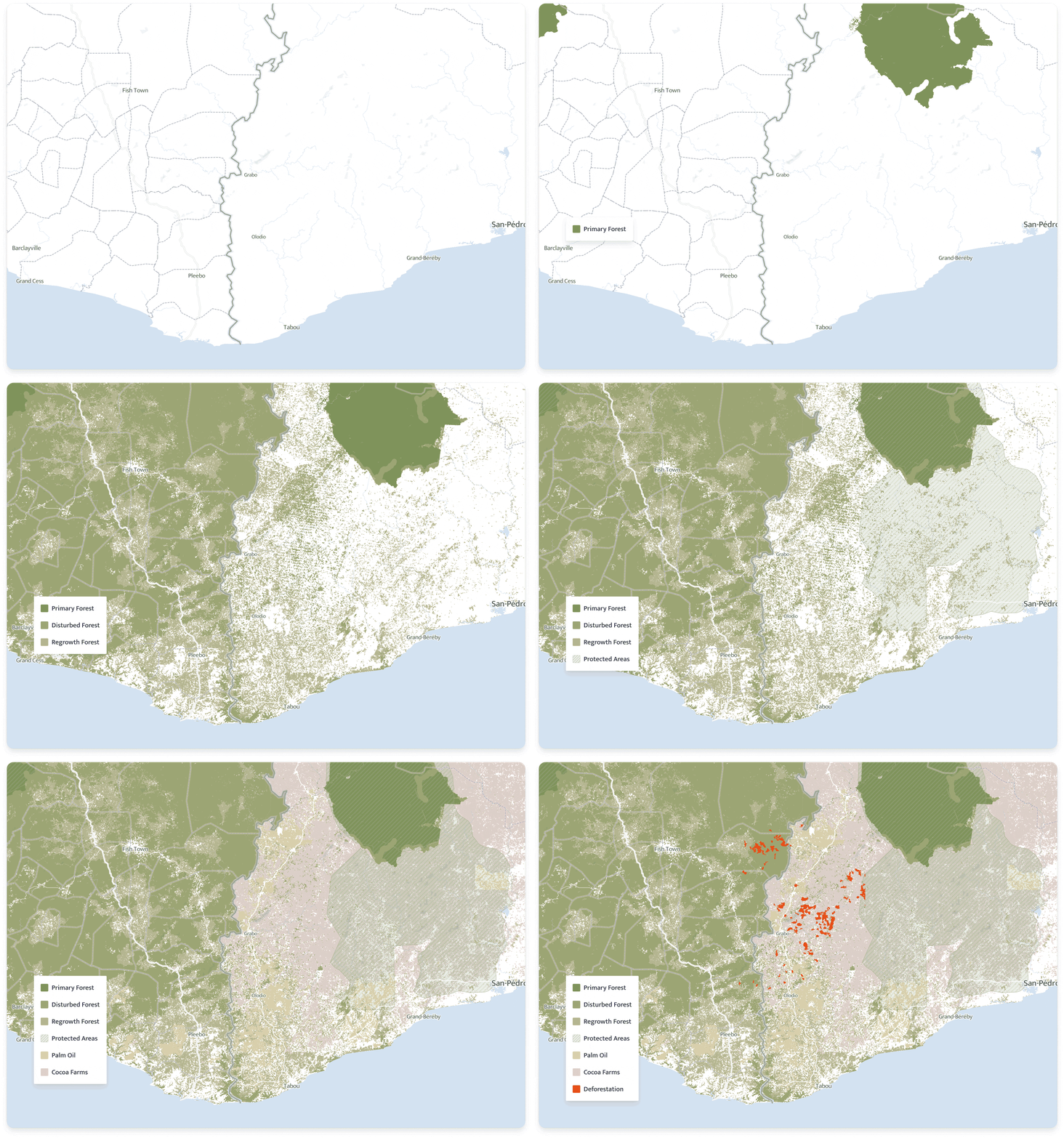
Example of commodity and forest layers monitoring
With the above criteria, Satelligence adapted the existing FLRI to create a scalable version with more accurate forest land cover and deforestation information. Their version of the FLRI covers the entire landscape on a pixel-by-pixel basis; it isn’t limited by farm boundaries. Additional input data makes it easier to distinguish between different kinds of tree loss. For example, cutting within plantations can sometimes be mistaken for deforestation. These false positives can lead to skewed data that can exaggerate supply chain deforestation or the severity of risk in a given farm. This way, Touton aren’t overwhelmed by data; curation means that they are free to focus only on the farms that are verified as high risk.
Terrain, road networks and population density were classified as secondary risk factors as they are outside of Touton’s control. Therefore, areas with a high potential for intervention are areas where primary risk factors are high and secondary risk factors are low.
The result is a traffic light system that classifies farms as high, medium or low risk. The advanced FLRI allows Touton to answer the question: how does a company identify deforestation that’s yet to happen? With the FLRI they can identify deforestation hotspots, target interventions and prevent deforestation.
Phase 2: Nurturing the Future of Cocoa
Phase 1 built on OLAM and Global Forest Watch’s FLRI to lay the foundations of the project. These foundations support stakeholder engagement and direct action on the ground to improve accountability and transparency within the supply chain. Satelligence’s FLRI provides a depth of risk insight that, along with Touton’s roots in the region, creates ideal conditions for nurturing the cocoa farming industry in Ghana. On an operational level, this means continuous, real-time monitoring of medium and high risk locations.
Satelligence’s satellite-based land cover and deforestation mapping and monitoring system tracks vegetation changes on a daily basis, with reports every other week.
The Scope for phase 2 is defined by Satelligence as follows:
- Using the FLRI criteria, mark forest areas that are most under threat for real-time monitoring and intervention;
- Cultivate relationships with community-based environmental committees to identify key personnel who can investigate and document risks first-hand;
- Establish boots-on-the-ground procedures for verification of land-use changes caught on satellite;
- Standardise reporting and documentation of findings;
- Maintain operation of satellite systems to detect changes continuously and ensure on-the-ground staff are deployed to the right place at the right time;
- Share results of on-the-ground investigations with relevant stakeholders, measure progress and document findings;
- Formulate plans for intervention and follow-up actions.

The follow-up actions enabled by Satelligence’s monitoring infrastructure will make all the difference for the farming communities of West Africa. Close affiliation with Touton means that farmers can be provided one on one deforestation coaching, monitoring and support to ensure continued access to global markets, and that their product isn’t associated with deforestation. On-the-ground interventions will allow Touton to help farmers with replanting or, better yet, enrichment planting and to take part in legal discussions about demarcation or degazettement.
Interested in monitoring deforestation for cocoa production?
