Deforestation remains one of the greatest risks to our climate, biodiversity, and supply chains. Regulators, investors, and consumers now expect companies to prove that their products are deforestation-free. What once required explanation is now a baseline expectation: sustainability is no longer about “why,” but about “how.”
And that’s where Satelligence comes in. We transform satellite data into decision-ready insights that help companies act with confidence, stay EUDR compliant, and protect biodiversity. But our story didn’t begin in an office, behind a laptop. It began over two decades ago, in the heart of the Indonesian jungle.
Our roots in the jungle
In the early 2000s, two research students from Wageningen University, Niels Wielaard and Arjen Vrielink set out to monitor forestry practices using radar systems deep in the Indonesian jungle. Their mission: detect gaps in the forest canopy and distinguish between sustainable and unsustainable practices.
When they arrived, they found vast fire-burned landscapes. Their research forest was being cut down before their study could even begin. The experience revealed a stark truth: the tension between local economic development and the destruction of rich, biodiverse ecosystems.
With a love of technology and a passion for people and nature, they set out to find solutions that could align livelihoods with conservation. The seed of Satelligence was planted.
“Inspired by my great grandmother’s stories of Indonesia, I developed a fascination for tropical forests and their people. Traveling the world, I saw both the devastation of deforestation and the resilience of local communities. Those experiences shaped my belief that technology could bridge the gap between economy and ecology — and ultimately led to Satelligence.”
— Niels Wielaard, Founder & CEO

Turning commodity risk into opportunity
Fast forward to today. Deforestation still challenges businesses and communities worldwide. Traceability across global supply chains is often poor, and incomplete or fragmented sustainability data leads to inefficient and costly decision-making and processes.
On top of this, when data is incomplete or unreliable, it can create confusion in supply chains and even lead to accusations that don’t always reflect reality on the ground. For companies trying to do the right thing, this creates reputational risk. When evidence is shaky, the consequences for brand trust and public perception are real.
That’s why Satelligence exists. We believe a thriving planet and profitable business go hand in hand. Our AI-powered, EY-audited platform provides independent, real-time, third-party verified insights into deforestation, carbon emissions, biodiversity, and land-use change.
By combining radar and optical satellite data with local expertise, we give companies a complete and trusted view of their supply chains. EUDR compliance becomes more than a checkbox — it’s a chance to build resilience, strengthen trust, and turn sustainability into a competitive advantage.
The result is both peace of mind for companies getting it right and a clear path forward when challenges arise.
")
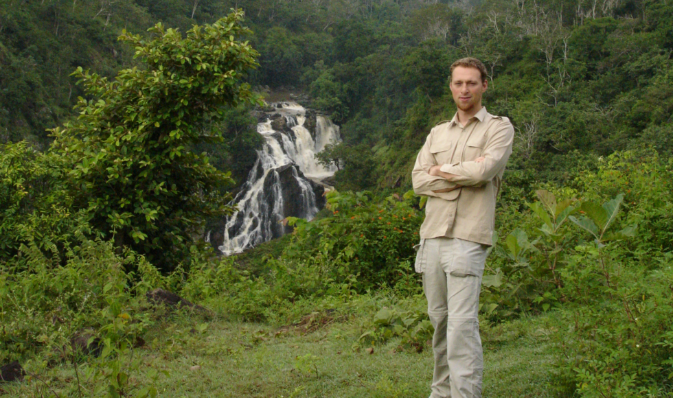
Field visit in Indonesia in 2014
Towards deforestation-free supply chains
There are many drivers behind the movement for deforestation-free products. Consumer preference is one. Ethically-sourced and environmentally friendly products are fast becoming an expectation. They’re also important for investors with sustainable portfolios looking for complete traceability and accountability. And now, regulation is reshaping the playing field.
In regions such as the EU, the EU Deforestation Regulation (EUDR) will soon come into force. Large and medium companies must comply from December 2025, and SMEs by June 2026. The law requires operators of commodities like cocoa, coffee, palm oil, soy, rubber, and wood to prove their products are deforestation-free.
But the move towards deforestation-free supply chains is about more than just compliance. Companies that act early can:
- Build resilient sourcing networks
- Reduce supply chain disruptions
- Strengthen consumer and investor confidence
- Demonstrate leadership on climate and biodiversity goals
Protecting forests means safeguarding biodiversity, securing carbon stores, and supporting the communities who depend on them. Deforestation-free sourcing is both a responsibility and an opportunity.

Field visit in Vietnam in 2016
Grounded in partnership, driven by purpose
Satelligence isn’t just another sustainability platform. Born in the jungles, built through decades of fieldwork, and proven at global scale, we are the trusted partner for businesses committed to impact.
With offices in Utrecht, Jakarta, Abidjan, and São Paulo, we remain grounded in the same pioneering spirit that started it all: protecting businesses, people, and the planet.
At Satelligence, we don’t just help companies meet standards — we help them redefine them.
Ready to lead?
Get in touch below to discover how we can provide complete transparency and insight into your supply chain.