
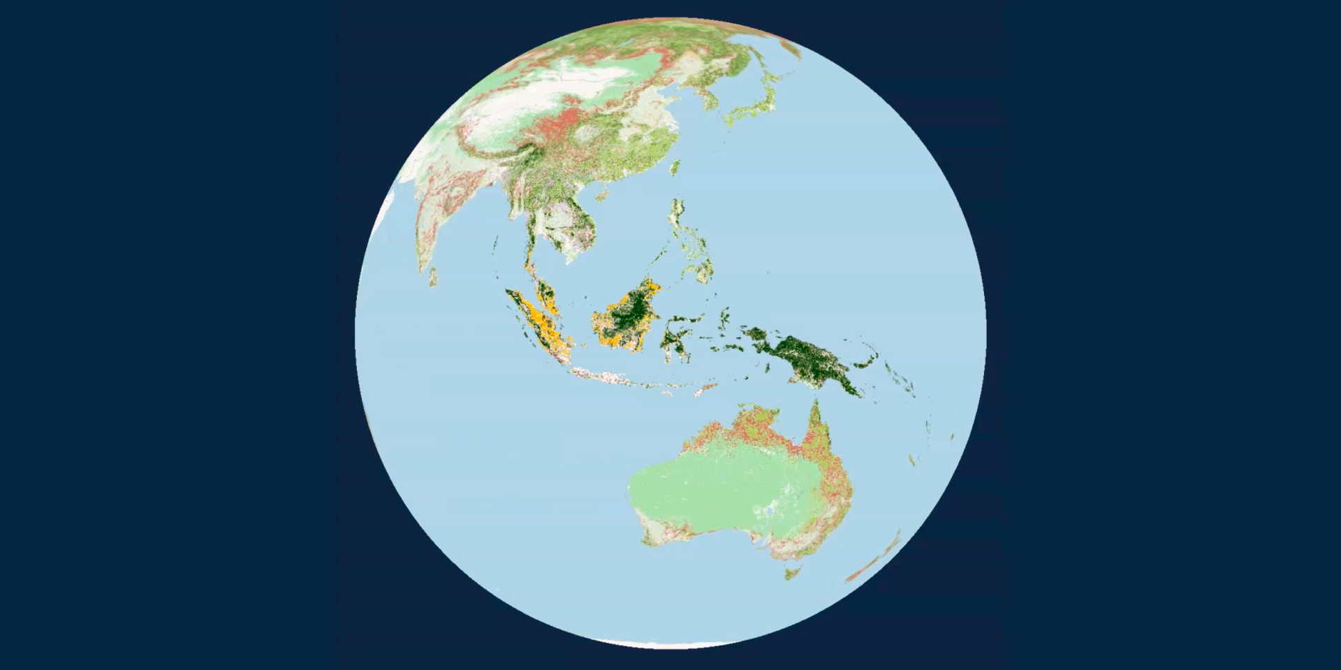
As companies bring more nature & climate data into supply chain decisions, consistency is key. Satelligence’s jdLUC and jDCF layers provide two complementary perspectives on land use from the same Harmonised Nature & Commodity Baseline, connecting DCF risk and land-use change emissions across jurisdictions.
Aligned decisions require consistent climate data
Companies are increasingly bridging environmental data into the decisions that shape their supply chains, from sourcing and supplier engagement to climate targets, investment, and risk management.
But, as the number of datasets grows, another question becomes evermore important: are the different teams making those decisions working from the same source of truth?
A procurement team may be looking at deforestation and conversion risk. A climate team may be calculating land-use change emissions. A sustainability team may be assessing progress against a DCF target. And a finance team may be considering physical risk and resilience.
The point is that each dataset can be useful in its own right, but when they define and describe land use differently, connecting those insights becomes much harder – teams begin to prioritise different locations, suppliers, or interventions based on the datasets they favour. In order to make decisions aligned with interrelated goals, teams need to use consistent data.
Harmonised Nature & Commodity Baseline
Satelligence has spent the past ten years building its Harmonised Nature & Commodity Baseline; a consistent view of land use across global agricultural supply chains.
Bringing together more than 100 land-cover datasets, the baseline is continuously refined to distinguish meaningful land-use change from the noise that can occur when working with multiple, individual datasets.
From this harmonised foundation, we can assess deforestation and conversion and land-use change emissions, using the same underlying baseline and data foundation. The consistency of such a baseline enables Satelligence to connect nature & climate impacts and understand whether an intervention is actually changing the outcome.
What do we mean by jdLUC and jDCF?
Jurisdictional Deforestation- and Conversion-Free (jDCF)
Provides a consistent view of deforestation and conversion risk per commodity across jurisdictions, from national to local levels.
Jurisdictional direct Land-Use Change (jdLUC)
Translates the same underlying land-use intelligence into a view of land-use change emissions per commodity at a jurisdictional level.
When these two layers are connected, it is possible to consider where to source both DCF and low carbon commodity volumes and where supplier and landscape interventions might actually positively impact supply chain emissions and nature loss.
What is the value of the jurisdictional approach?
Supply chain traceability can provide detailed information about individual farms and plots, but it is not always available at the same level of detail across every commodity, supplier, or geography.
A jurisdictional view provides another perspective; it is a consistent way to understand land-use dynamics across an entire administrative area, from national to local level. This helps companies to see their individual (siloed) supply chain information against the broader landscape context, identifying patterns, comparing specific areas, creating benchmarks, and understanding how land-use change is evolving over time.
The goal is not to create another dataset that needs managing, but a more coherent evidence base that different teams can use to inform the decisions they are already making through the following potential applications:
Sourcing and procurement: Understand how land-use risks and emissions are distributed across sourcing regions and use that information to inform supplier engagement and sourcing strategies.
Climate and carbon accounting: Use consistent land-use change data in order to understand supply chain emissions & product carbon footprints.
Nature and climate action: Bring DCF and LUC perspective together to identify where interventions could address multiple impacts instead of treating nature and climate as separate workflows.
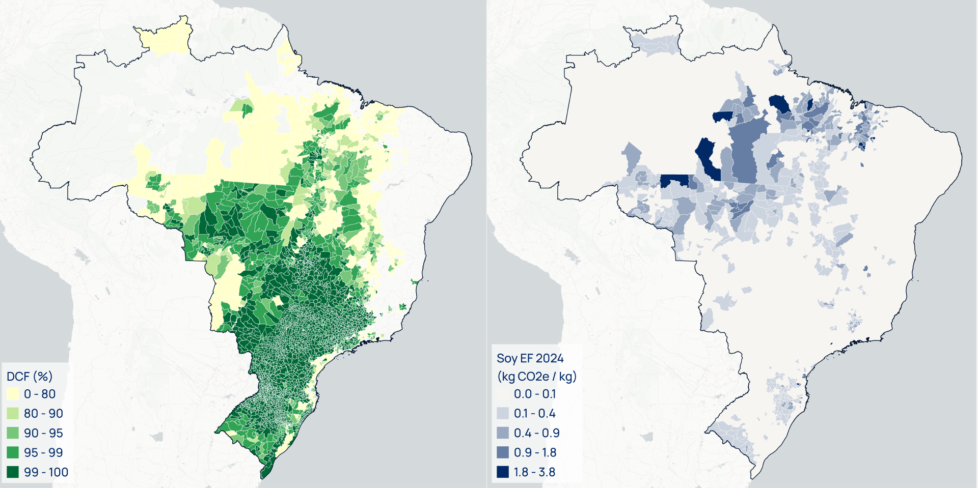
Consistent climate data with land use intelligence is the new norm
Deforestation, conversion, and land-use change are all interconnected on the ground, so why would the data to understand them not be connected too?
Satelligence believes that environmental data poses the greatest value when it can be consistently used across the systems and decisions that shape supply chains. This is why we also make this data available through our partnerships with companies such as HowGood and Sourcemap. Such partnerships reflect a broader opportunity of bringing the same underlying view of land use into the tools that companies already use to understand their products, suppliers, and environmental impacts.
An integrated nature and climate strategy has evolved far beyond access to data; it is now about whether that data can be connected, compared, and used consistently across a company and, eventually, a sector or industry.
With jdLUC and jDCF, Satelligence brings these perspectives together through one continuously updated view of land use, providing global coverage whilst retaining the local-level insights needed to understand where change is happening, what are the relative impacts, and where can you make the most difference.