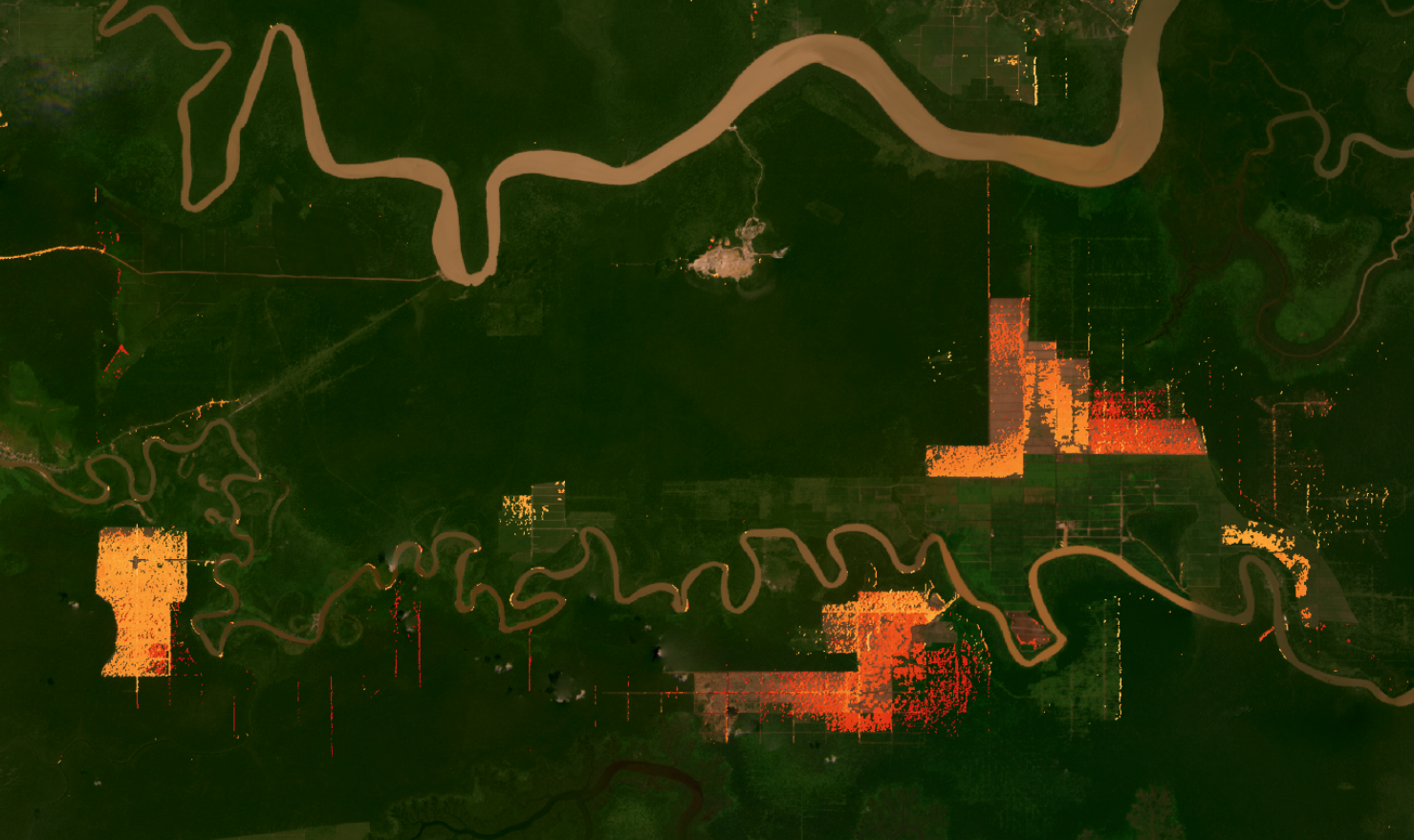
RADD: Public radar-based deforestation monitoring
Rainforests, as the name suggests, are often rainy— which means they are also frequently cloudy. This has long presented an issue for forest monitoring, since traditional satellite technology is unable to “see” through obstructions like clouds, smoke and haze. However, the new Radar for Detecting Deforestation (RADD) alerts detect forest disturbances rain or shine using satellite-based radar data.
We are proud to present RADD alerts. Facilitated by the World Resources Institute, the project is a collaboration between Wageningen University, which developed the detection method, and Satelligence which first scaled the system in Indonesia and Malaysia and provided additional prioritisation of the alerts in order to identify the most important areas for on-the-ground follow up. The ten companies continue to be critical users of the RADD alert system.
The RADD alert system is capable of achieving much finer forest disturbance detail and is able to do so several weeks earlier than optical-based systems. It is also the first radar-based monitoring system of this scale to make forest disturbance alerts publicly available.
We believe that building on scientific methods like this is the way to achieve industry-wide transparency and consensus, which is crucial as tackling deforestation is a collective undertaking.
Applauding the palm oil sector for kickstarting this amazing effort, we see similar initiative in cocoa, rubber, soy and beef sectors.
About RADD
Launched in early November, the new Radar Alerts for Detecting Deforestation – or RADD – system is set to make a real difference in palm oil sector collaboration, demonstrating the potential for genuine transparency in tropical commodity supply chains. Ten of the world’s leading palm oil businesses – including producers and buyers from Bunge, Cargill, Golden Agri-Resources, Mondelez, Musim Mas, Nestlé, PepsiCo, Sime Darby, Unilever and Wilmar – are involved in the initiative.
The companies are providing funding to develop a radar- based monitoring system that will allow them, and other interested stakeholders, to follow deforestation in near real-time and with much greater certainty than in the past. Such cooperation between a large group of competing companies is unprecedented – particularly when the aim is that the resulting system will be publicly available.

Real-time monitoring
Radar satellite imagery from the European Space Agency’s Sentinel-1 mission is used to map new disturbances in primary humid tropical forest at 10 m spatial scale and in near real-time.
Seeing through the clouds
Sentinel-1’s cloud-penetrating radar provides gap-free observations for the tropics consistently every 6 to 12 days. In the densely cloud covered tropics, this represents a major advantage for the rapid detection of small-scale forest disturbances such as subsistence agriculture and selective logging. The RADD (RAdar for Detecting Deforestation) alerts contribute to the World Resources Institute’s Global Forest Watch initiative in providing timely and accurate information to support a wide range of stakeholders in sustainable forest management and law enforcement activities against illegal deforestation. The RADD alerts are implemented in Google Earth Engine. RADD alerts are available openly via Google Earth Engine and the Global Forest Watch platform.
Disturbance detection algorithm
A new forest disturbance alert is triggered based on a single observation from the latest Sentinel-1 C-band radar image. Subsequent observations are used to iteratively update the forest disturbance probability, increase confidence and confirm or reject the alert. Forest disturbance is defined as the complete or partial removal of tree cover within a 10 m Sentinel-1 pixel. Complete tree cover removal is associated with stand-replacement disturbance at the Sentinel-1 pixel scale, while partial removal mainly represents disturbances associated with boundary pixels and selective logging.
Next challenge is to enable acting on deforestation.
Combining the basic RADD disturbance alerts with advanced analysis enables specific actionable questions to be answered.
- What is deforestation and what isn’t?
- What is legal or illegal?
- What are the causes (drivers)?
- Who do we contact to mitigate problems?
- What happens to all forest and plantations outside of the scope of this public RADD coverage?
- What happened before 2019?
