About Sime Darby
Sime Darby Oils is the world’s leading producers of certified sustainable palm oil. They offer a great range of deep frying oils for the catering industry. Next, their product range offers quality professional baking fat ingredients ingredients to artisanal bakers. Also, they supply vegetable oil ingredients in bulk for industrial use in the food and personal care sectors.
The Context
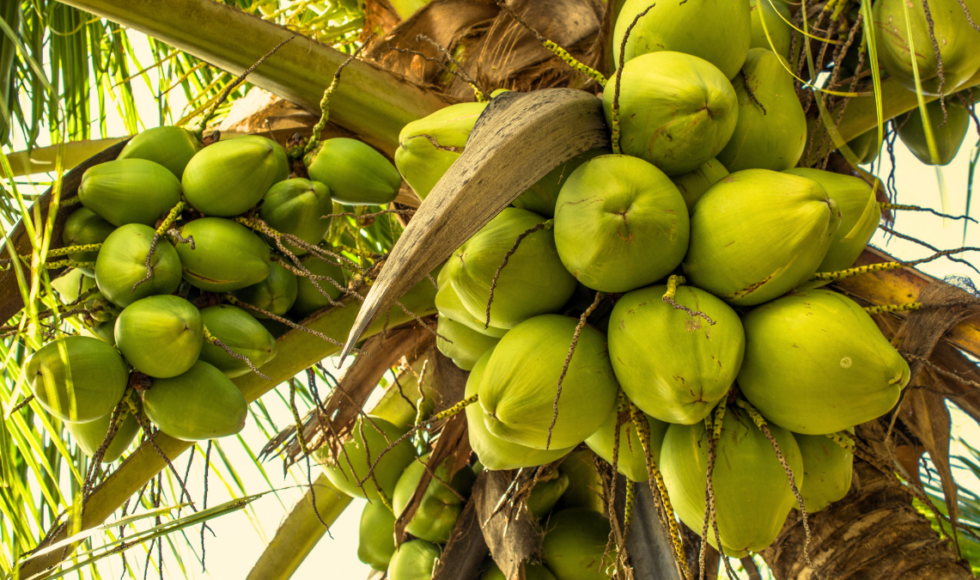
Very little public information is available detailing the extent, age and agricultural capacity of Papua New Guinea’s coconut plantations. A dearth of information is detrimental to the development of the market. Business cases require evidence; predicting future yields requires information; intelligent decisions around sourcing require reliable data points.
That’s why Sime Darby Oils Berhad initiated a call for a service provider to carry out a coconut mapping assignment in Papua New Guinea which would verify regional sourcing assumptions and assist in the preparation of business cases.
Satelligence was pleased to offer its expertise in remote sensing and commodity intelligence to help Sime Darby Oils accurately estimate coconut yield in Papua New Guinea, helping them discover market opportunities for producing commercially viable coconut.
The Solution
Deliverable 1: Coconut mapping
Satelligence provides a land use map displaying the following classes for the Area of Interest:
- Coconut
- Palm oil
- Forest
- Other/Non Forest
Satelligence has experience mapping coconut in Malaysia, Indonesia and Papua New Guinea and uses best practices and science-based approaches to ensure industry-leading accuracy.
Deliverable 2: Coconut age mapping
Satelligence provides coconut age mapping with the following age categories for the Area of Interest.
- 0-10 years
- 10-20 years
- >20 years
The age of the coconut tree is tied to its agricultural capacity, as it will cease to produce fruit after a certain amount of time.

The Methodology
Information on coconut distribution and age is either not readily available for Papua New Guinea, or out of date, so Satelligence developed a coconut palm basemap (2021) and coconut age map (1984-2021) covering the main coconut growing catchment areas.
To build the map, Satelligence used 10m resolution Sentinel-2 optical satellite imagery and advanced machine learning techniques designed specifically for coconut, and tailored to the environmental nuances of Papua New Guinea’s agricultural landscape.
The basemap is able to provide key insights not only on coconut, but for four different land-use classes: coconut, palm oil, forest, and other/non forest. The map covers a total area of 200,000km², excluding land over 1,000m above sea level, and more than 50km from the coast. The coconut age map includes three age categories: 0-10 years, 10-20 years, and >20 years. Images of coconut trees that are +20 years old are unavailable.
Satelligence’s mapping approach is based on machine learning algorithms with the capacity to differentiate coconut palm from other land cover classes. The algorithm analyses open-source satellite imagery from 2020-2021 (ESA Copernicus Sentinel-2) at a 10 metre resolution. To obtain the age classification they used the NASA Landsat archive dating back to 1984.
To create an accurate coconut palm basemap, Satelligence separated the spectrum signal of coconut palm from comparable vegetation categories like palm oil, natural (palm) forest, water bodies, or urban and bare areas. In order to include additional forest classes like primary forest, they applied their 2021 update of the University of Maryland 2001 primary forest layer. The class known as degraded forest refers to forested areas cleared or severely logged at any point since 1984.

Figure 2: Overview basemap of the project area in Papua New Guinea. Areas outside the study area are lighter in colour.
In order to detect the age of the palm, the coconut palm layer is then combined with Satelligence’s deforestation detection algorithm, which identifies the last moment in time where an area was cleared from vegetation. They can then retrieve the age of the coconut palms for that specific location. The same steps are followed for mapping oil palm plantations.
The Findings
The basemap and age maps were aggregated down to the catchment levels of seven coconut plantation regions, as provided by Sime Darby Oils. The analysis includes calculations of the total planted areas and percentages of age classes per catchment, as well as the totals for the full project area in Papua New Guinea.
The total coconut palm area in the mapped area is 199,818 hectares. Across this area, 121,346 hectares of palm oil were also mapped. The majority of coconut plantations throughout the country were planted more than 20 years ago, with some smaller areas showing younger plantations of coconut.
The insights outlined here were delivered in GIS format, through an accessible Satelligence web viewer, with complimentary analysis and statistics for each Sime Darby Oils catchment area.
Figure 3: Coconut palm basemap of East New Britain, Papua New Guinea.
