Most complete supply chain data.
Most consistent deforestation data.
And more.

Satelligence delivers unmatched data and insights on supply chain assets, planted crops, ecosystems and risks.
We provide a traceability platform that helps companies to prove compliance and emission reduction throughout their value chains.
- Data and derived insights readily analyzed and visualized in our platform
- Insights as customized Pdf reports
- High quality data feed (API) to generate insights within your own information system
Our tech will bring you closer to your supply chain than ever before, at a fraction of the cost of traditional measurement and reporting. Unbiased. Relevant. Realtime. Reliable.
What sets our technology apart?
- Trustworthiness. Proven for years by leading clients
- 10 m detail. Near-real time. Globally. Daily. 95% accuracy or better
- Access 3m detail for additional verification and confirmation. Globally
- First ever reliable planted commodity layers. At field level detail. Globally
- Science-based. Published methods developed with leading scientists
- Curated and contextualized by experts. 25 years of on-the-ground experience
- EY certified audit-ready and Google assured low carbon footprint service
- Serious about security & privacy
Traceability and analytics platform
Get real-time insights & reporting
- App to empower your suppliers and field agents on the ground with insights
- Field-to-Consumer supply chain visibility and control
- Find and mitigate risks faster than ever
- Resolve grievances more efficiently
- Always on the same page with your supply chain partners and peers
High quality data
Unlock the world’s most powerful Geolocated Assets and Supplier-Buyer relations database and satellite-derived supply chain risk data combined.
Supply chain asset data

Achieve radical supply chain visibility
Acting on non-compliances like deforestation or reducing emissions is only possible if you can link them to plots of land, production origins and specific suppliers.
Our Global Database of Geolocated Assets and Supplier-Buyer relations is the basis for documenting evidence of non-compliance with regulations and sourcing policies and commitments.
Thanks to our exceptional database, we can screen suppliers, and profile supplier risk and performance to a single farm or aggregate to specific supplier level, verify compliance, and identify and resolve supplier-specific grievances.
Satellite and field-derived data
Be the first to know, first to act
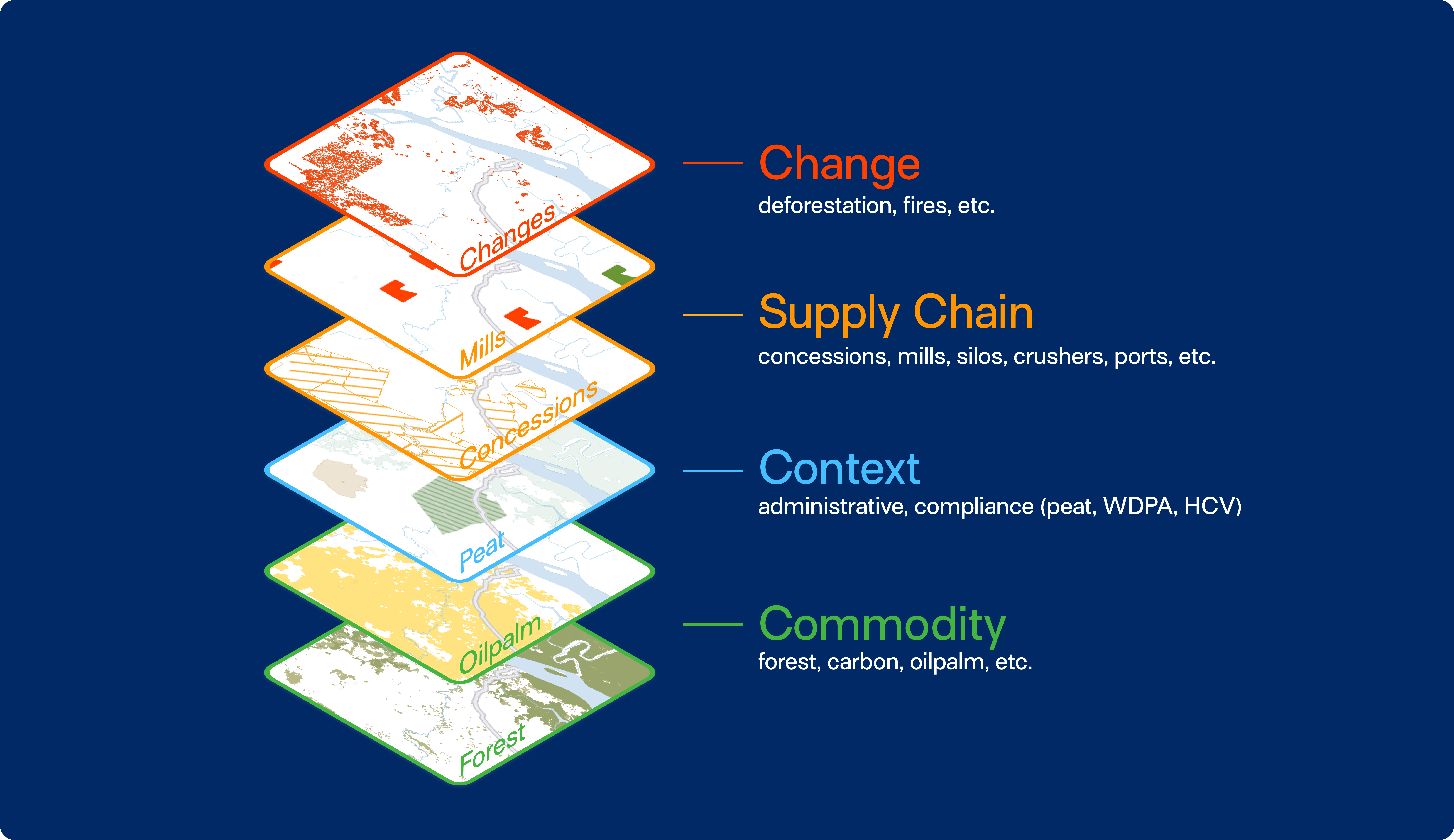
Mapping and monitoring 6 billion hectares, using extensive ground presence, human intelligence, advanced optical and radar satellite data, laser scanning (LiDAR) and specialized AI/machine learning software within a high performance cloud computing environment.
We spent a decade perfecting our processing resulting in the most crisp, cloud and haze free quality data input on the market to generate:
We distinctively curate and contextualize, integrating the best aspects of open data. Forest redefined by national and EU/FAO definitions. Careful adherence to forest definitions is inevitable for compliance. And boosts industry-consensus.
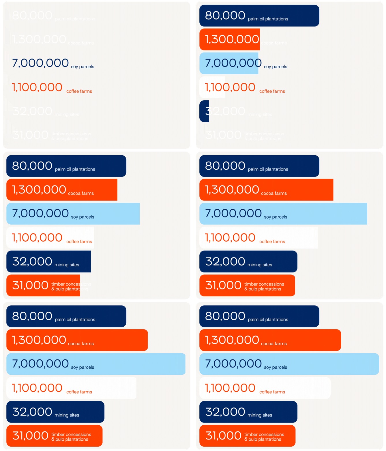
The geolocation, plot boundaries and ownership of farms, plantations as well as cooperatives, elevators, silos, crushers, warehouses, mills, refineries, etc. Connecting the dots to map all supplier relations and trade flows with supplier-buyer linkages, i.e. who sources from whom?
- More timely than the best available open and government data: up to 12-16 months earlier and near realtime
- More accurate than the best available open data: 95% instead of just 70-80%. Checked in the field by our network of clients, partners and accomplished local experts. Ensuring very strict quality control
- More actionable than just ‘data’: incorporating contextual intelligence on drivers, and distinctive clustering and prioritisation of alerts. So you can follow up where it matters most. Saving time and money
- Extensive local field surveys and proprietary airborne LiDAR measurements in different biomes across 11 tropical forest countries.
- Global spaceborne LiDAR measurements.
- Pioneering fusion of optical, radar and LiDAR sensor data.
- State-of-the-art machine learning models to generate accepted predictions and 40 year time series with quantified uncertainty.
Our carbon data meets the principles and requirements of the GHG protocol and SBTi FLAG. Certified by Ernst & Young, we are an approved service provider for Verra and PlanVivo.
We have been trailblazing high detail measurement of agroforestry emission reductions and removals at scale, to empower and reward smallholders. Check out our work powering the Rabobank-Microsoft smallholder carbon marketplace Acorn.

On the ground presence
24/7 support
Often overlooked, but critical to success. We have access to data and knowledge from the field all around the world through our local offices and our large network of partners. In addition to the millions of farm and concession boundaries, we gathered over 200 million vegetation and crop ground truth points around the world over the years.
We use the ground truth data to calibrate and validate our forest baseline, planted crop and deforestation detection algorithms. For maximum reliability.
EY Certified audit-ready data
First-hand insights into sustainability progress and compliance: make sure you can use such data in your sustainability reports and marketing claims with confidence. Our deforestation and carbon data is certified by Ernst & Young ISAE 3000. Meaning our methodology is not only transparent but also reliable. Providing the assurance you need.
Satelligence is the world’s first provider offering EY-certified audit-ready insights.
Powered by Google
Our partnership with Google Cloud Platform (GCP) powers the massive computational and storage capacity to generate our unique global layers that enable us to monitor 6 billion hectares daily. Google’s unique efforts to decarbonize their operations allow us to provide a low energy intensive service.
“We’re entering a new era of sustainability driven business transformation, which cloud is key to enabling and accelerating that transformation. The Google Cloud partner ecosystem will play a key role in providing solutions that help our joint customers deliver on their sustainability goals”.
Justin Keeble – Managing Director of Global Sustainability at Google Cloud
We are here to help you
Get in touch
Our expert analyst team makes sure you can remain continuously up to date thanks to the tireless monitoring of changing sustainability compliance legislation and best practice. We are directly involved in all standard-setting industry initiatives and coalitions.