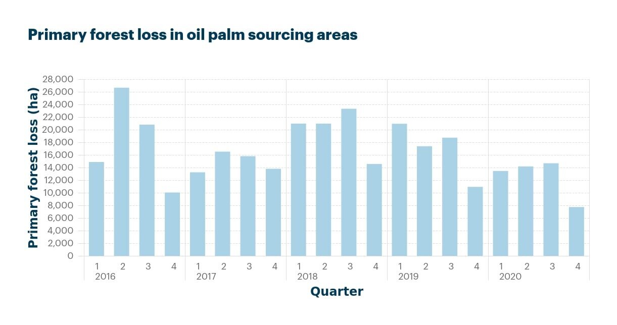
Our colleague Vassilis Prymidis, Data Scientist at Satelligence, has proven that Deforestation rates in Malaysia have significantly declined in 2020, despite fears of the impact of COVID-19.
Earth.org has published Vassilis’ research.
What is Happening?
- Based on automated analysis of tens of thousands of images from the Sentinel-1,2 and Landsat satellites over primary ‘untouched’ forest, Satelligence found that there were lower rates of primary forest loss in Malaysia, on average, in 2020 compared to the average loss from 2016-2019.
- Publicly available datasets, such as the latest tree forest loss dataset from Hansen et al., also indicate that primary forest loss has been less than in recent years.
“To make sure you get the best results we continuously check our algorithms for timeliness, spatial resolution and accuracy”
Map showing the full area for which the Satelligence system provides operational insights on a daily basis.

How to get reliable deforestation alerts
Free available data may sound a bit cheap. But if you want your deforestation alert to be of any use, reliability is most important. To make sure you get the best results we continuously check our algorithms for timeliness, spatial resolution and accuracy.
Furthermore, we compare our algorithms to other available systems out there; see table below.
