We hear it all the time… “We need to be net zero by 2030!” or “We need a better way to measure our scope 3 emissions and removals from deforestation and investments in restoration.”
Companies are increasingly committed to cutting carbon emissions. In food and agriculture, a significant challenge is tackling land use change emissions, a crucial part of any Scope 3 reduction strategy. Many companies rely on spend-based or country-level emission factors, but these often overestimate emissions from deforestation for specific commodities and sourcing areas.
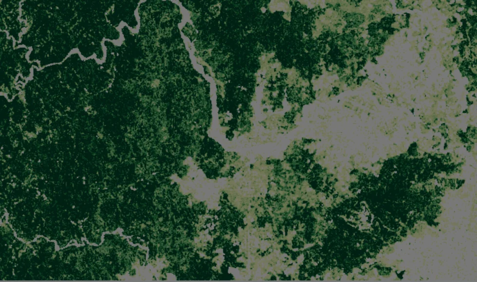
To improve scope 3 measurement and reporting, companies are turning to solutions like satellite-based carbon monitoring.
While everyone uses machine learning, AI, spaceborne LIDAR data (GEDI), and a fusion of optical and radar imagery, offering carbon monitoring at 10m resolution, the true differentiator is the input data quality and understanding of land use change and vegetation in the tropics.
We offer:
- Best-in-class forest baseline.
- Global commodity maps (e.g. cocoa, coffee, soy, palm) using training data from our extensive network.
- 10m deforestation detection data at >95% accuracy, globally.
By combining this with publicly available earth observation data (Sentinel 1-2 and GEDI), we produce highly consistent and coherent above-ground biomass estimates at 10m resolution.
Our forest and commodity baseline accuracy and change detection are built on:
- The quality of our satellite image cloud-free composites and mosaics, enabled by our own sensor-agnostic satellite image processing engine;
- The quality and quantity of our training data set
This approach allows us to provide consistent and coherent above-ground biomass and deforestation detection data at 10m resolution globally for a 20-year time series.

We help our clients:
- Contextualize carbon data with supply chain assets and sourcing landscapes to provide plot-level Scope 3 emissions and removals insights, improving reporting and emission reduction strategies
- Measure landscape carbon trends to track progress on nature-positive goals, forest carbon project performance, and identify strategic areas for restoration
- Create reliable emission factors for specific commodities, geographies, and suppliers using data and methods fully aligned with the GHG Protocol and Science-Based Targets FLA
What our clients do to prepare for the EUDR with us also accelerates the creation of high-quality emission factors for their climate action plans and other sustainability goals like NDPE, TNFD, and SBTN.