Empowering your sustainable sourcing transition.
Compliance with sustainable sourcing regulations and deforestation-free commitments like the EUDR, Scope 3 and NDPE can be complex and overwhelming. How do you make sure your supply chain is deforestation-free? How do you account for and report on your carbon emissions? What’s the most efficient way to start? Which suppliers are the best performers, and which ones aren’t?
We empower businesses to transition to a sustainable sourcing model, reduce scope 3 emissions, and simplify compliance with the EUDR, and other deforestation-free commitments. With our extensive knowledge and science-based, EY-certified methods, we ensure you can stay compliant, meet your commitments and report on your progress with confidence.
Compliance
EUDR
Export and import forest-risk ,raw materials and products to Europe and beyond with confidence.
We empower compliance with the EUDR by verifying, at the plot level, that your commodities are not linked to deforestation. Use our information to submit due diligence statements to the EU Information System.
Sustainable sourcing
NDPE V-DCF
Time-saving responsible sourcing and investment decision-making support.
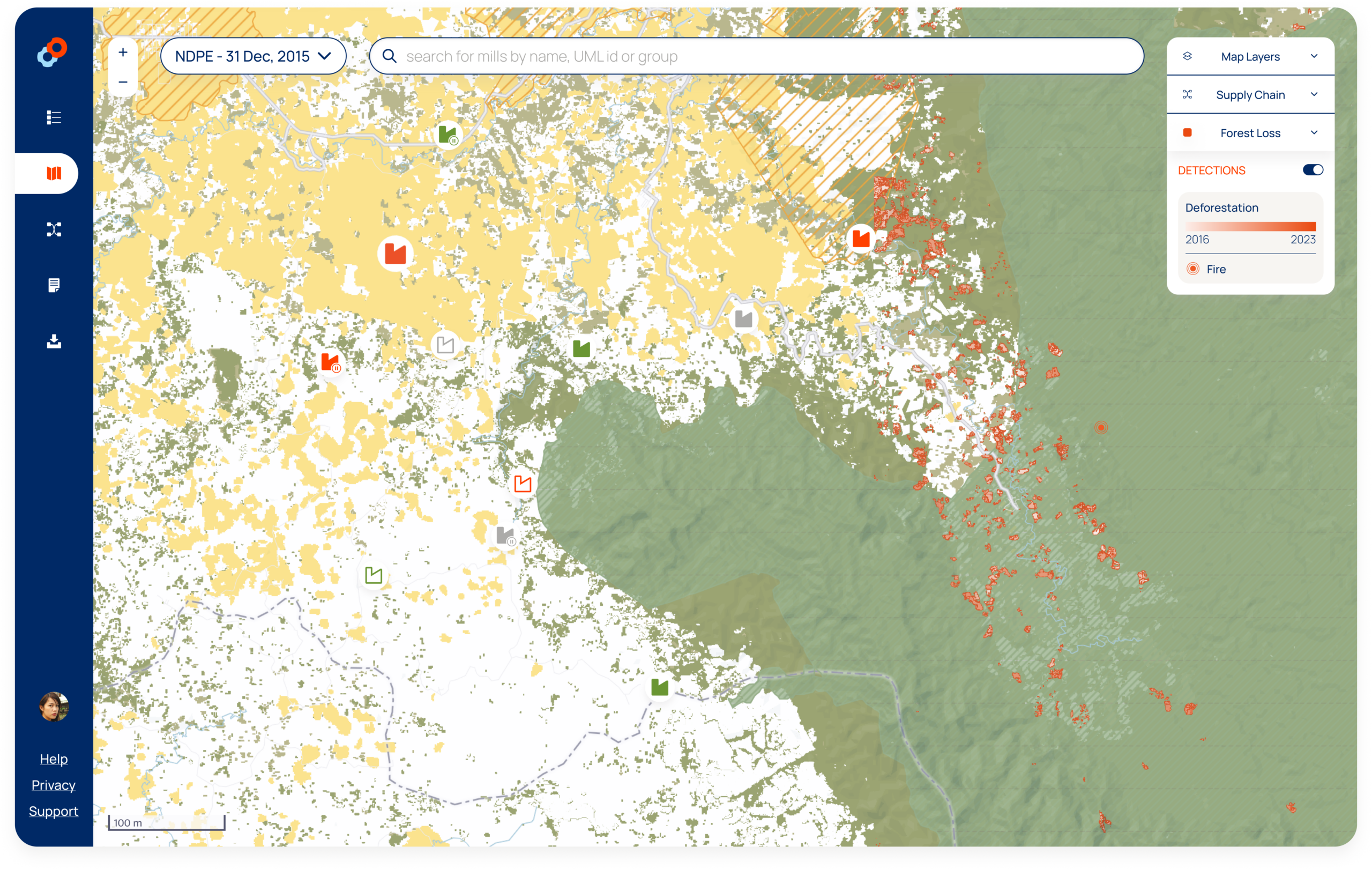
Whether it’s NDPE, CFI, Soy Moratorium, RSPO or any other commitment, and regardless of the cutoff date that it requires, we have the tools and guidance you need. Take control of your transition to a sustainable supply chain and can prove your compliance with sustainable sourcing commitments and regulations.
Scope 3
CSRD, GHGp, SBTi FLAG
Measure and monitor land-based emission reductions and removals with confidence.
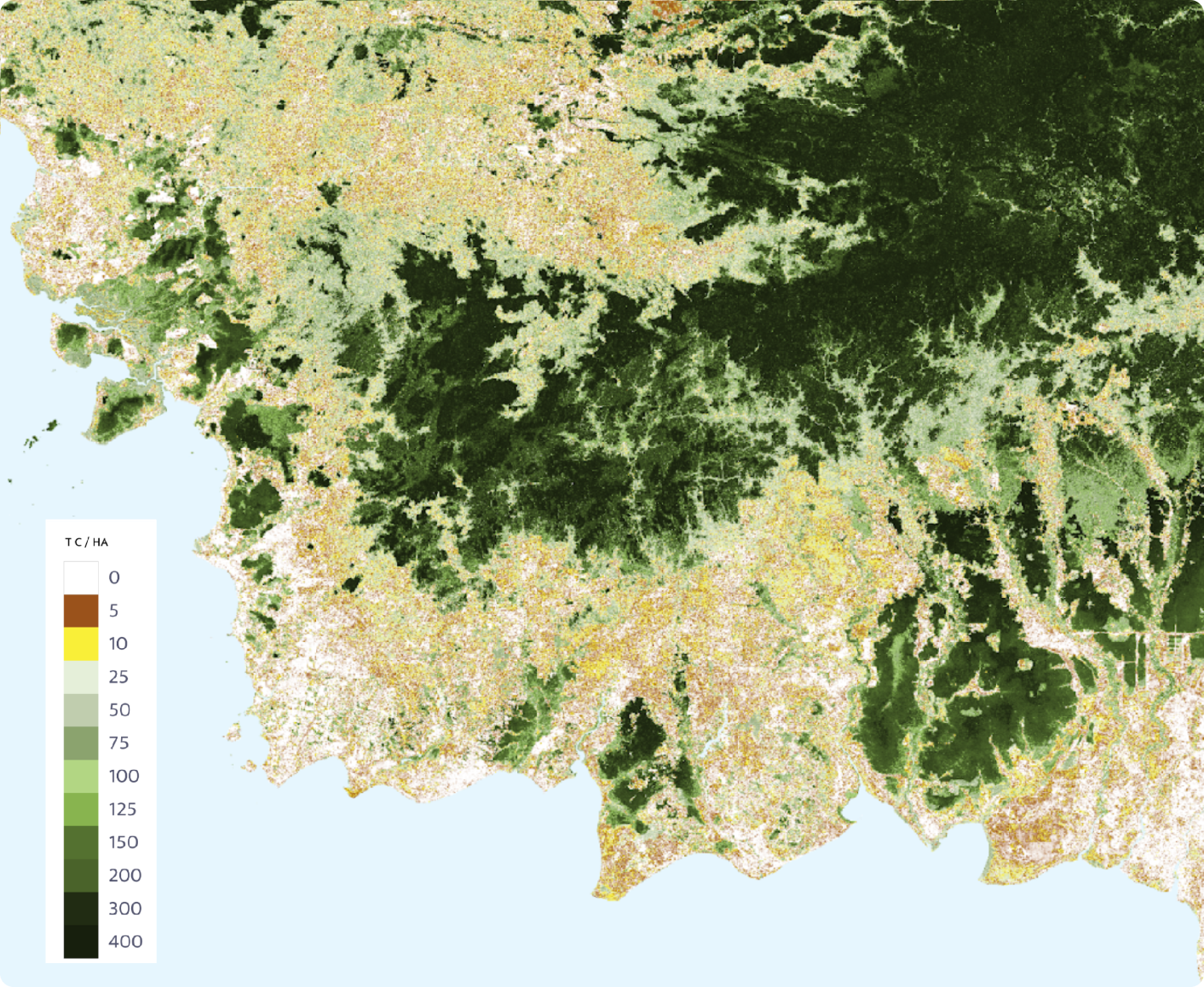
Satelligence’s tools empower you to meet your GHG reporting obligations under the CSRD with science-based and audit-ready reports. Monitor emissions throughout your supply chain by leveraging the most robust traceability and carbon stock change data available.
We are here to resolve any of your doubts.
2. Lowest carbon footprint. Spending years on improving cloud computing efficiency at scale also means we require less energy to deliver results covering entire global supply chains. Thanks to Google we are able to quantify and report the limited emissions associated with our service.
3. Best input data. Having worked in cloudy and hazy tropical areas for years, we were forced to build the best image preprocessing engine in the world. Creating the highest quality cloud and haze free input pixels. We don’t process noise to create noise. Example: 3m carbon data may look fantastic, but most of what you see is noise. There is a reason the best available data is available at 10-30m resolution. As with digital camera’s: don’t fall for the Megapixel myth: more Megapixels DOES NOT mean better quality photos.
3. Contextual intelligence. You benefit from 25 years of struggling in remote areas. Measuring trees. Surveying vegetation. We know what we are talking about. We know a forest in Indonesia is rather different from a forest in Ghana or a forest in Brazil. We know what a palm oil plantation is. We know how diverse cocoa management systems can be. We know how coffee is produced. Because we have been there. We saw it with our own eyes.
4. Carbon data is not what matters. What matters is reporting your Emission Factors. So you need integration of supply chain data, commodity layers and historical deforestation data. We offer a best in class solution integrating all these components combined. Globally. Temporally consistent. Coherent.
5. We are nice people.
Just knowing a specific patch of land stores 50 tonnes of carbon is insufficient: if it is not known whether it is associated to your supply chain, or associated with the commodity in focus, such information is worthless.
A cocoa plantation, young palm plantation, shrubland, and young regrowth forest can all have the same carbon stock. Satelligence’s exceptional traceability database and global commodity layers make carbon assessments superbly relevant.
Don’t risk overreporting of your emission reductions and removals using non-specific carbon data. And losing market share.
For example, if you produce or source cocoa from Ghana, why should your carbon footprint be inflated by massive emissions from nearby gold mining and logging? Using our distinctive cocoa maps we are able to limit quantification to cocoa.
Using more specific and more granular data gives precise estimates. Leading to better market access. Buyers increasingly choose low carbon density suppliers. Be one of them.
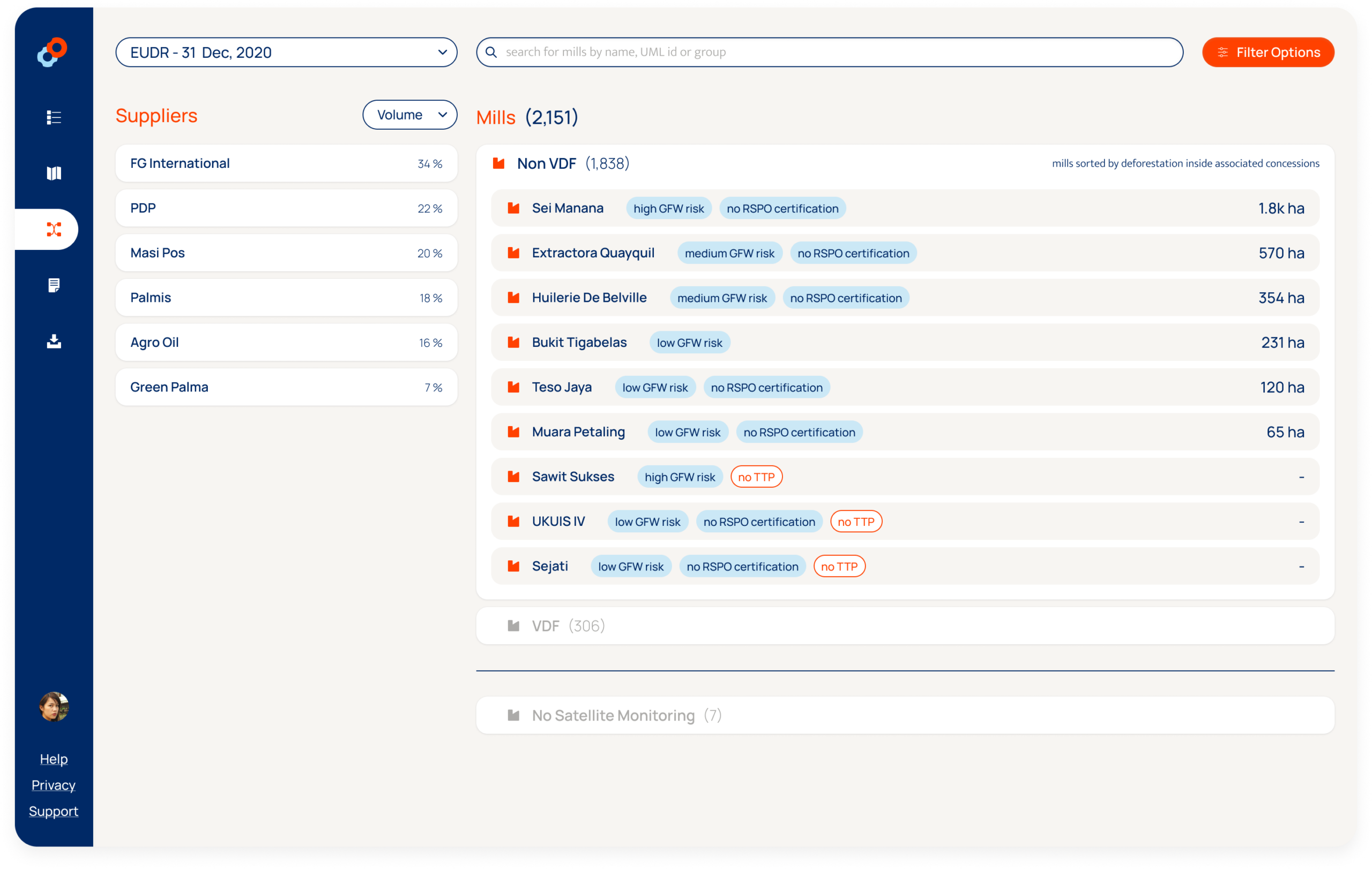
We guide you through best practice using monitoring for the implementation of sustainable business models. In order to support procurement decisions our system screens all suppliers in the industry: who are the top performers? Who need support to raise the bar?
We unburden you in engagement with suppliers, buyers and other stakeholders, saving time by automating tracking down grievances, reporting of actions taken and progress. Our highly responsive development team is flexible adapting our service to your workflows. Our customer success team is standby providing a Helpdesk for tailor-made support.
Get strategic advice on how to best integrate monitoring in your work processes. We develop state of the art approaches with leading stakeholder initiatives. Satelligence works together with a large network of local and international partners. Providing strategic advice on forest and supply chain monitoring to CGF, POCG, WCF, RTRS, IDH, GPI, Norwegian Government, Netherlands Government etc.
Satelligence is uniquely positioned to ensure that a wide network of suppliers is united, as we are involved in setting the standard, we foster cooperation and efficiency, and our client-base has the critical mass to push our work as industry-consensus.
Our app
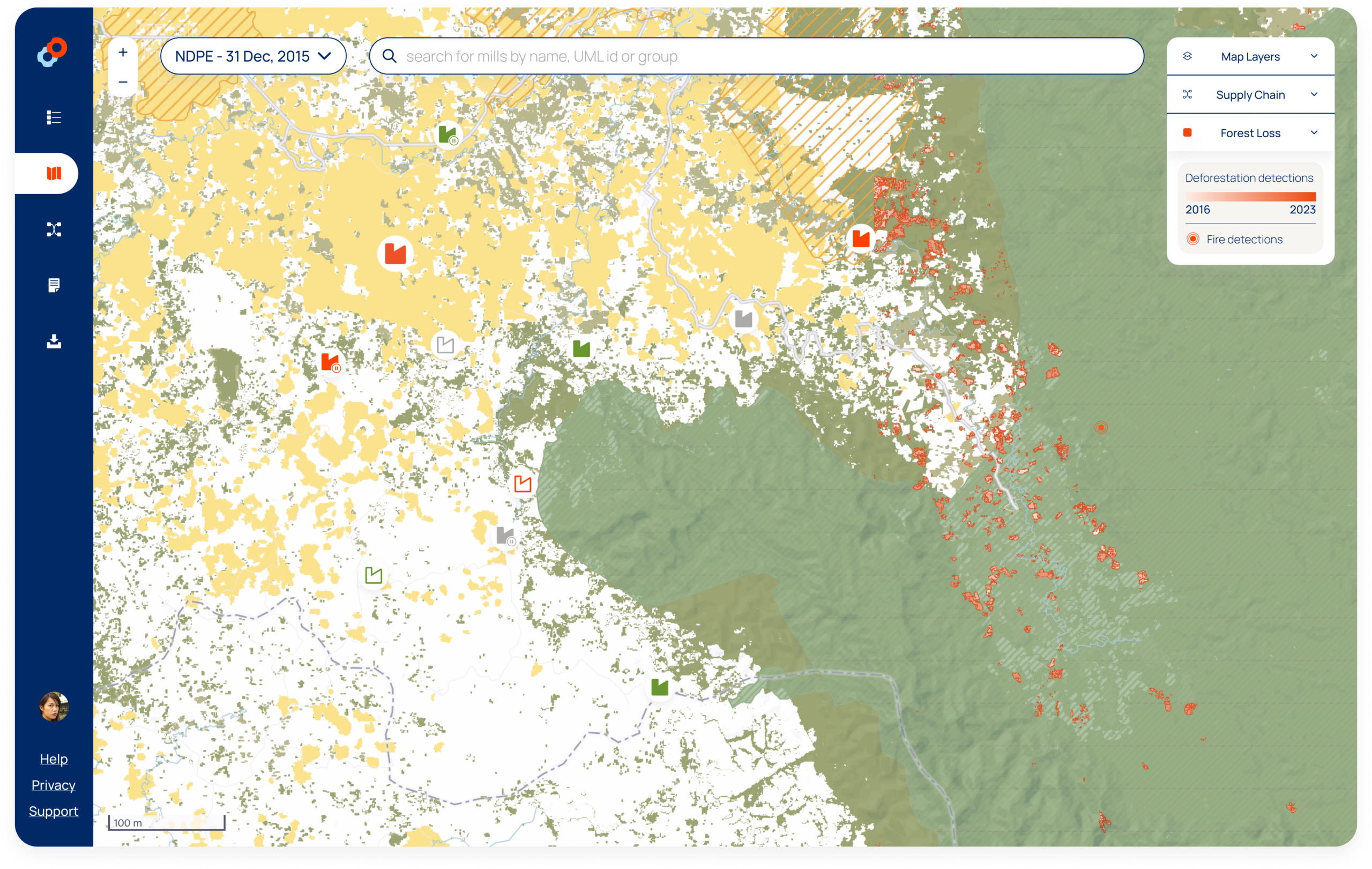
A real-time app that proactively identifies risk hotspots and gives real-time alerts on deforestation & fire risk. suply chain risk overview, and quick identification of risk sources.
PDF export
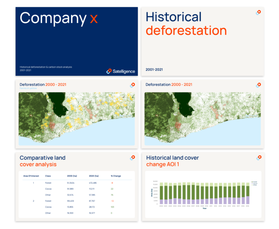
Monthly or quarterly PDF progress reports offered on a subscription basis.
Data export
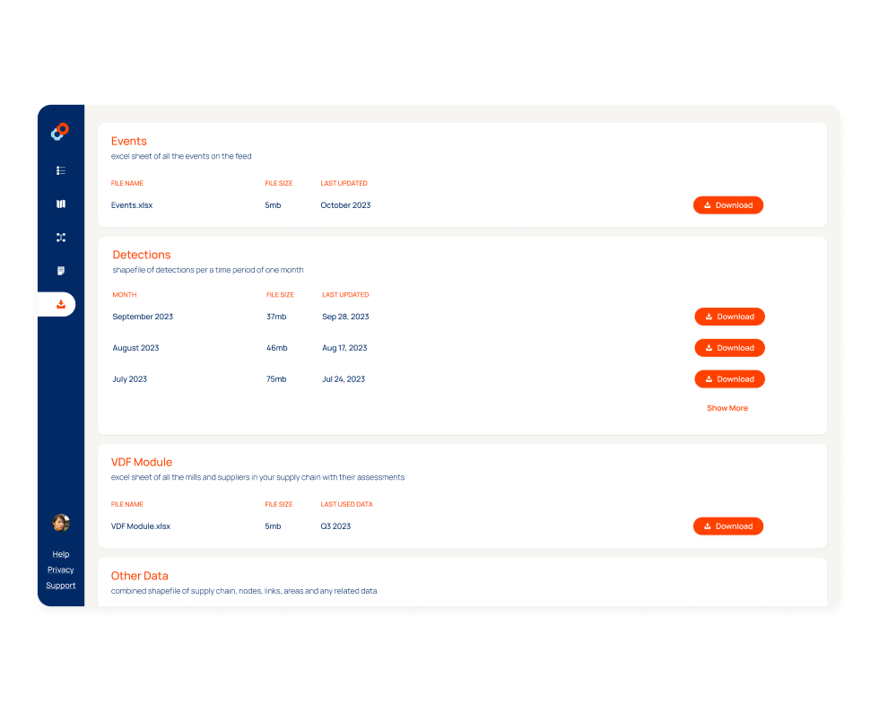
Export our data to office, Excel, PDF, Arcgis, GFW PRO & GIS.
Our clients are the first to know
EY certification
We are the first remote sensing company to have our deforestation monitoring services assured by a big four accounting firm. Ernst & Young certified the 2020 deforestation KPIs for a region in Riau, Indonesia. The report is an example of Satelligence’s transparent, reliable and robust methodology. Using assured data will strengthen reporting on your commitments to sustainability targets, such as those defined in the EU Taxonomy or for SDG15 (Life on land) related sustainability measures.
